AI TOOL / #08692
Picterra
A geospatial image analysis platform used for training and deploying machine learning models.
Introduction
Platform for training and deploying machine learning models for geospatial imagery analysis.
What is Picterra?
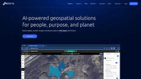
Picterra is a software platform designed to train, deploy, and manage machine learning models for the analysis of geospatial imagery. It enables users to detect objects, monitor changes, and identify patterns in satellite, drone, and aerial images at a speed of 95%. Picterra offers geospatial artificial intelligence solutions for various industries, helping companies optimize their workflows, rapidly identify objects, and promote sustainable development efforts.
How to use Picterra?
Users can upload satellite images, aerial photos, or drone footage to the Picterra platform to create custom AI models that are capable of detecting objects, changes, or patterns. They can then share their analysis results through interactive dashboards and reports. This platform is also integrated with Esri ArcGIS Pro and Safe FME.
The core functions of Picterra
Construction of custom AI models for geospatial imagery analysis
Object detection, change monitoring, and pattern recognition
Integration with Esri ArcGIS Pro and Safe FME
Interactive web reports and dashboards
Object detection, change monitoring, and pattern recognition
Integration with Esri ArcGIS Pro and Safe FME
Interactive web reports and dashboards
Related
Pancake
Enable AI agents to directly implement customer acquisition strategies.
withHuman
Manual approval mechanism for critical operations performed by AI agents
siliXon
In one sentence, it can be described as: a circuit board that is ready for ordering and production.
Takes
Claude Code helps you edit and produce videos.
Base44
Conversational application building platform under Wix
Kudos
An AI wallet that automatically selects the most cost-effective credit card.